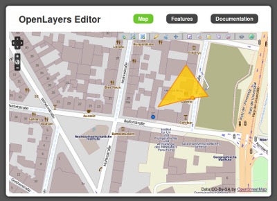
OpenLayers Editor released
OpenLayers Editor is an easy to use JavaScript library that brings geodata digitizing functions to the browser. Besides basic capturing of point, line and polygon data, OpenLayers Editor supports uploading of shape files, snapping, merging, splitting and validation of geometries.
The toolbar and all the functions attached to it are based exclusively on OpenLayers classes. No other client-side libraries like ExtJS or jQuery are needed. However some functions like validating geometries rely on server-side processing, e.g. with PostGIS.
Drupal users can take advantage of the OpenLayers Editor module which integrates well with the OpenLayers module and provides server-side processing if the PostGIS module is installed.
Source Code and documentation are available on Github. A Demo as well as a video show the toolbar in action.


